Day 1 Graphics
Day 1 Outlook

Day 1 Tornado Outlook

Day 1 Wind Outlook

Day 1 Hail Outlook

Surface Analysis
Visible Satellite
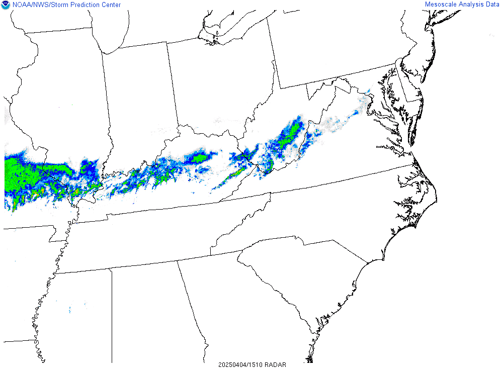
Radar Base Reflectivity
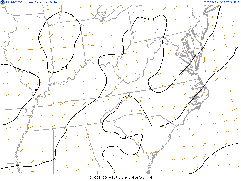
Surface MSLP/Wind
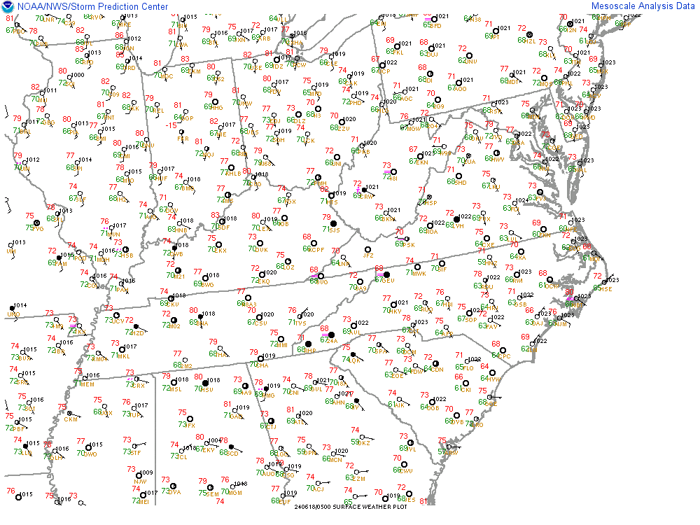
Temp/Wind/Dwpt

Moisture Convergence

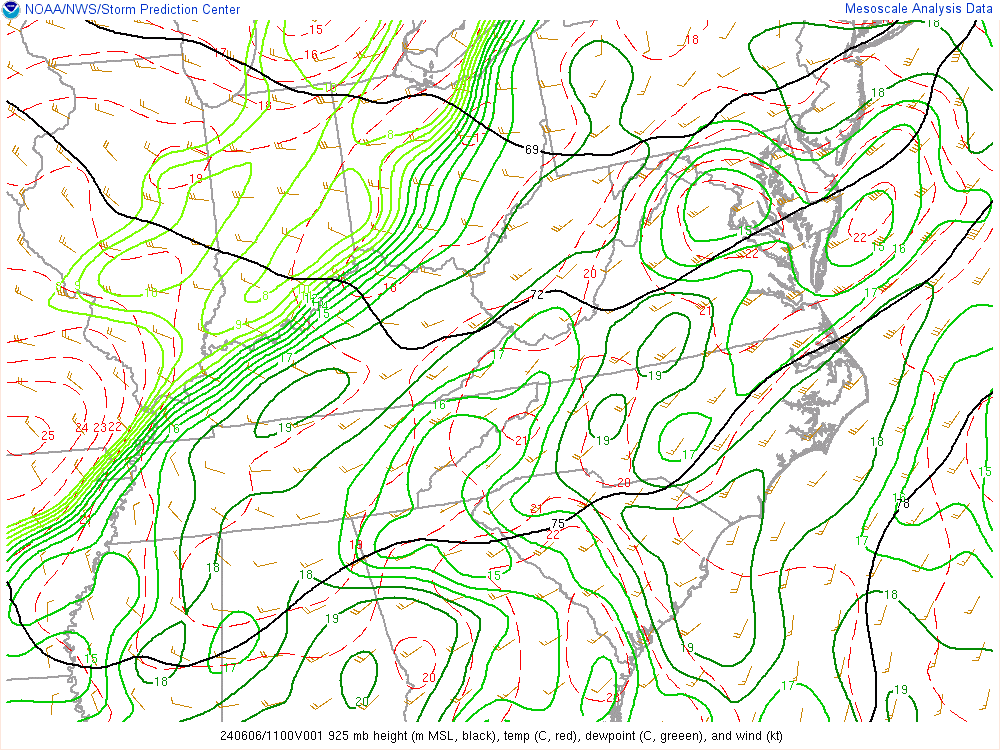
925mb Analysis
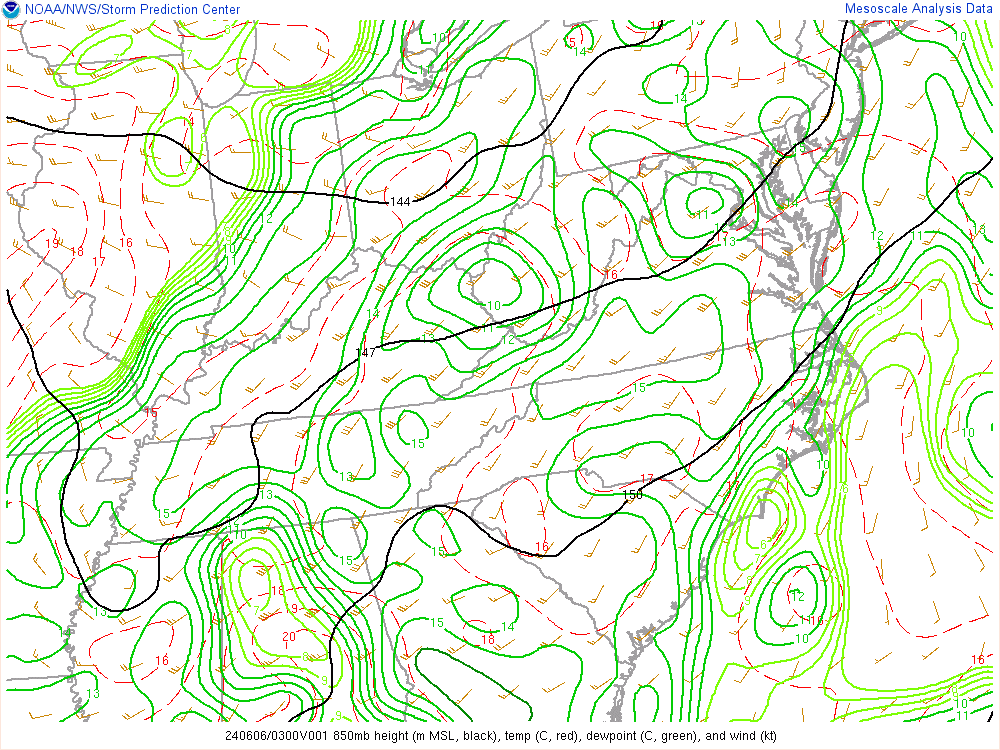
850mb Analysis
500mb Analysis

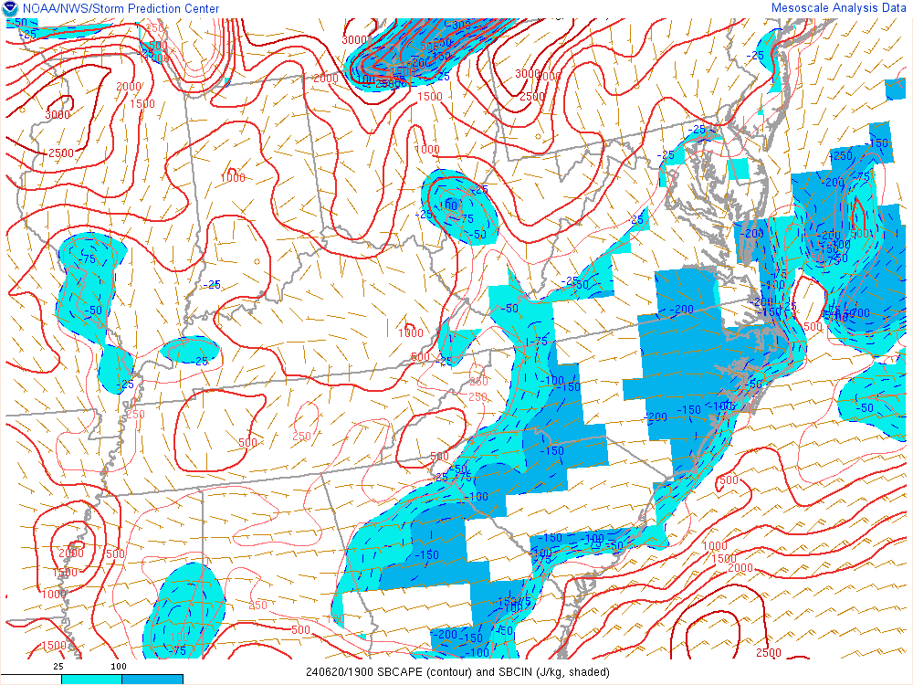
CAPE (Surface-Based)
CAPE (100mb Mixed-Layer)

Lifted Index (Surface-Based)

Mid-Level Lapse Rates

Low-Level Lapse Rates

Significant Hail
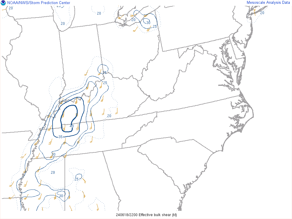
Bulk Shear (Effective)
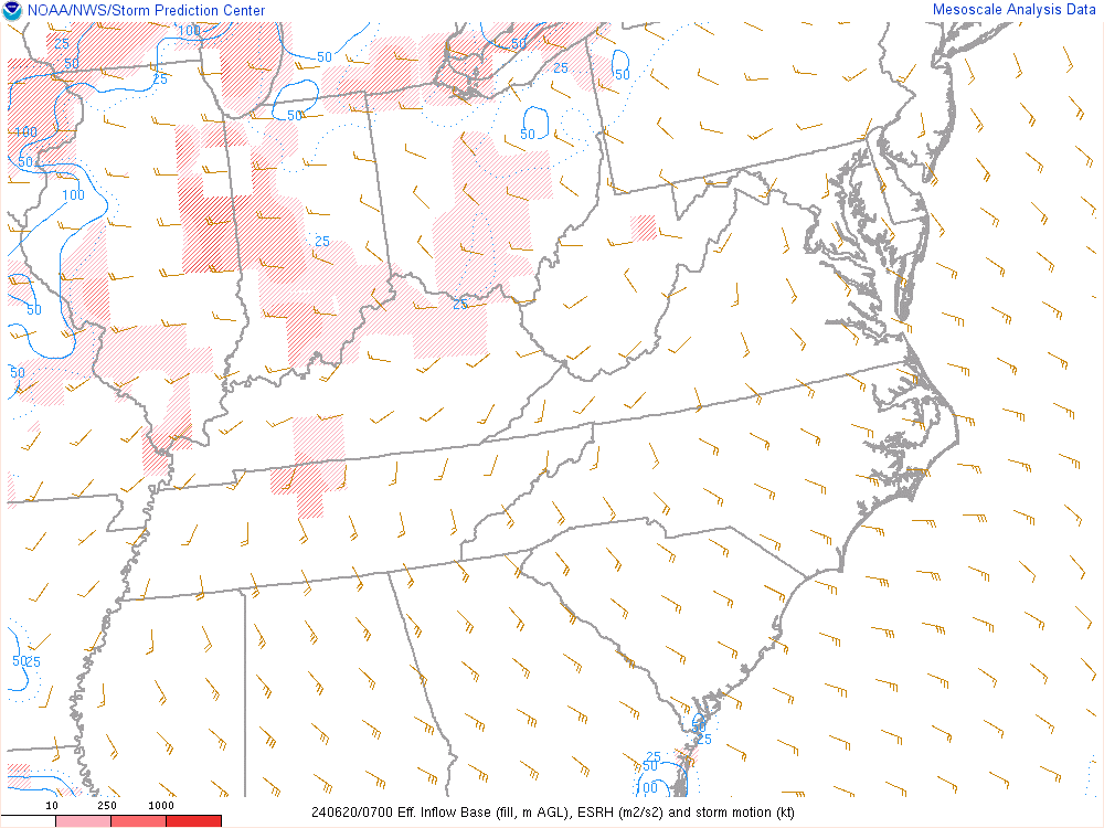
SR Helicity (Effective)
Significant Tornado

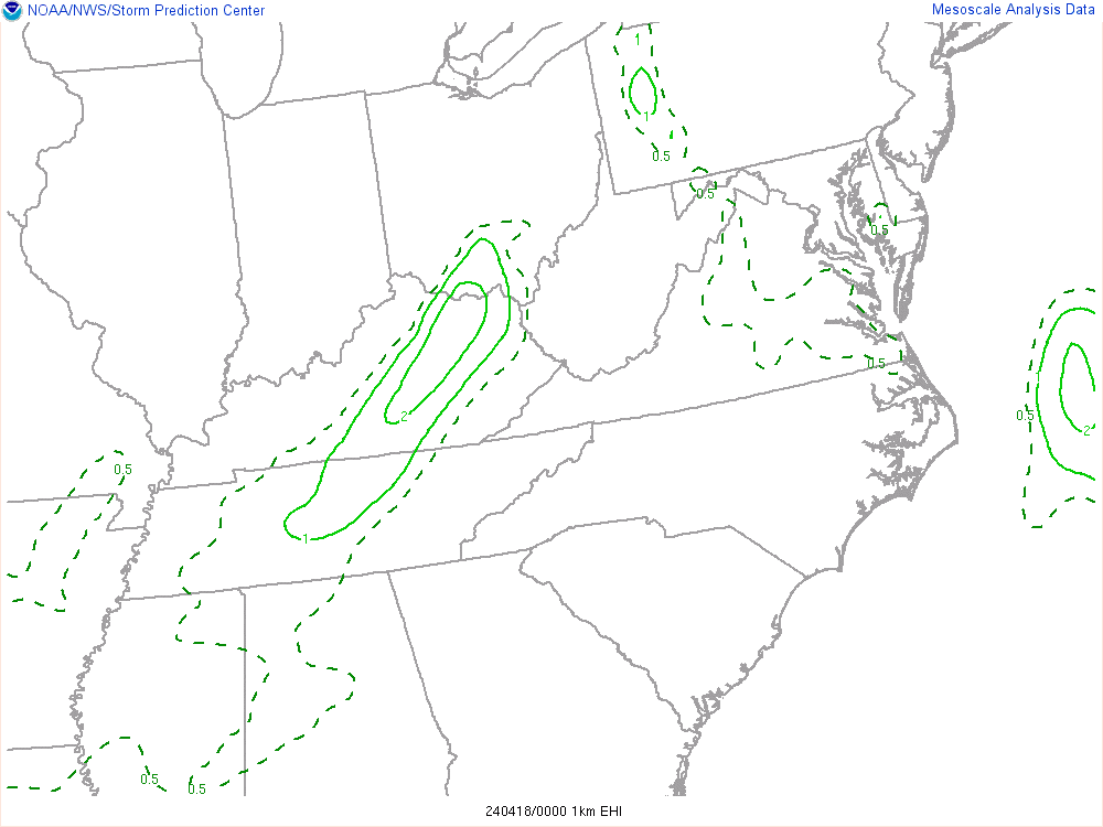
EHI (Sfc-1km)
3km VGP

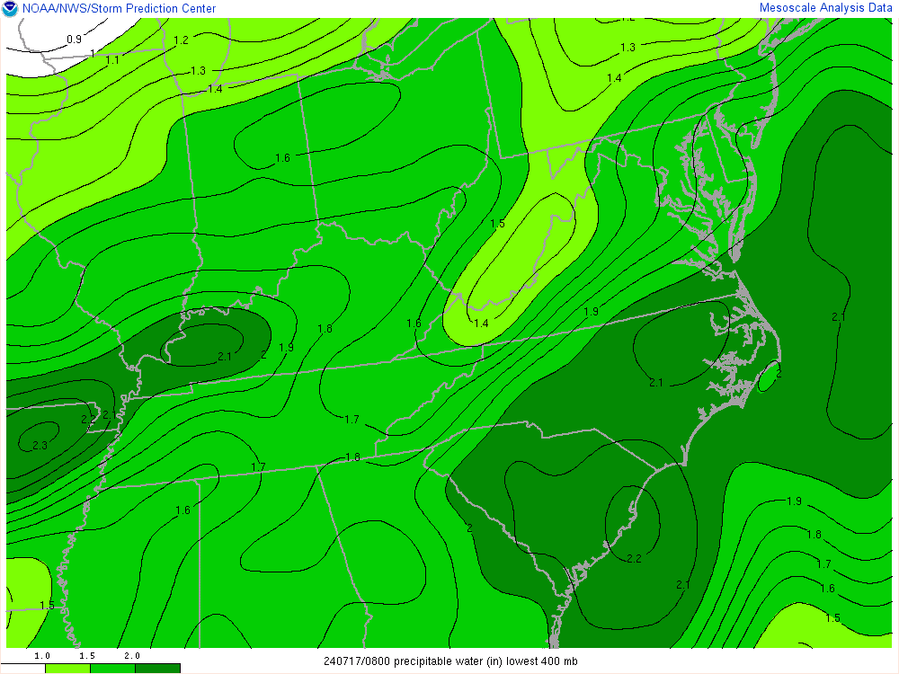
Precipitable Water